GIS System For an Optimized Business and Defense Roadmap
GIS System For an Optimized Business and Defense Roadmap
Unlock the Power of GIS Systems with MicroGenesis-IndiGIS Technology
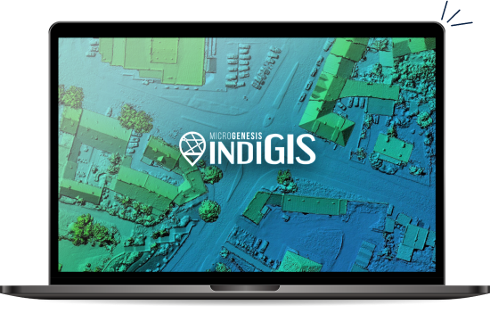
MicroGenesis has launched its IndiGIS platform, designed for businesses seeking powerful tools to manage and analyze spatial data.
IndiGIS is a comprehensive GIS software solution that provides a wide range of applications and offers our clients increased value with improved decision-making capabilities that generate greater efficiencies.
As the demand for using advanced GIS technology continues to rise across numerous industries, MicroGenesis’ expertise has put us in an ideal position at this critical juncture—opening up new opportunities through providing innovative solutions tailored precisely to these unique needs.
An Accomplishment to Honor!
A collaboration meant for Advanced GIS Applications
MicroGenesis has acquired IndiGIS through a technology collaboration with DRDO (Defence Research and Development Organisation).
DRDO initiated this transfer of technology (ToT) to promote the participation of the private sector in the proliferation of its technologies in military & commercial spaces.
The ToT is designed to enable large-scale use of this technology in constructing GIS applications for civilian and defense sectors of the Indian and international markets.
Our Domain Expertise
Focused geospatial deployment for industry-specific needs
Defense
Integrate, model, analyze and gain a complete understanding of the operational environment by leveraging the power of the GIS datasets.
Homeland Security
Enable & Improve national security with actionable, data-driven geospatial intelligence to make operations easier.
Government Sector
Leverage robust set of GIS tools to strengthen the sharing of spatial data across Government organizations.
Commercial/ Civilian Applications
Empower your businesses with GIS technology that provides powerful intelligence and insights to make better decisions and stay competitive.
Service and Solution Offering
Empower your organization with customized GIS solutions
GIS Consulting
Build a foolproof geospatial system with the best GIS practises and solutions.
Integration/Migration Services
Promote & move geospatial data effectively across individual organizations.
Extended Support with GIS Experts
Get comprehensive support for your entire GIS suite applications with our experienced experts.
Implementation Services
Bring the power of location & maps services to your applications.
Custom Plan Development
Create powerful location-based applications with the API of your choice and unlock the full potential of GIS with a custom-built plan.
How MicroGenesis can help?
Assisting organizations in making operational decisions with geo-enriched information
Improved Decision Making
Help make decisions about different projects and operations through robust systems
Effective Traceability
Effectively analyze and assess the relationships between geological entities.
Versatile Field Workflow
Can be used as a working station on its own or in integration with other systems to help with field operations.
Efficiency in Operations
Digital maps with detailed information about every motion on land, sea, and in the air to help with tracking and planning operations.

Get in Touch
Let’s talk about your Requirements
Gallery
