Natural resource management (NRM) is a multidisciplinary field aimed at sustainable management and conservation of natural resources such as water, land, forests, minerals, and biodiversity. Geographic Information Systems (GIS) have become indispensable tools in NRM due to their ability to capture, store, analyze, and visualize spatial data. GIS technology offers numerous applications in NRM, revolutionizing how resources are monitored, assessed, and managed. This article explores the diverse applications of GIS in natural resource management, highlighting its role in enhancing decision-making processes and promoting sustainable resource utilization.
Mapping and Inventory
GIS enables the creation of detailed maps and inventories of natural resources, facilitating comprehensive assessments of resource distribution and abundance. Through satellite imagery, aerial photographs, and ground-based data collection, GIS can accurately delineate boundaries, identify land cover types, and quantify resource stocks. For instance, GIS-based forest inventories provide valuable information on tree species, biomass, and forest health, aiding in sustainable forestry practices and conservation efforts.
GIS plays a crucial role in habitat and biodiversity conservation by modeling species distribution, identifying critical habitats, and assessing landscape connectivity. By integrating ecological data with spatial analysis techniques, GIS helps identify priority areas for conservation, establish wildlife corridors, and mitigate habitat fragmentation. Conservation organizations use GIS to monitor endangered species, track migration patterns, and assess the impact of human activities on biodiversity hotspots.
Water Resource Management
GIS applications in water resource management range from watershed delineation and hydrological modeling to water quality monitoring and flood risk assessment. GIS enables the integration of hydrological data such as rainfall, runoff, and soil permeability to simulate water flow patterns and predict potential flooding events. Additionally, GIS-based water quality mapping facilitates the identification of pollution sources, allocation of water resources, and development of strategies for watershed protection and restoration.
Land Use Planning and Agricultural Management
GIS technology supports land use planning and agricultural management by analyzing soil characteristics, assessing land suitability, and optimizing crop production. Farmers and land managers utilize GIS to make informed decisions regarding crop selection, irrigation scheduling, and fertilizer application. Furthermore, GIS-based land use planning helps minimize conflicts between agricultural expansion and conservation goals, promoting sustainable land use practices and preserving ecologically sensitive areas.
Natural Hazard Assessment and Mitigation
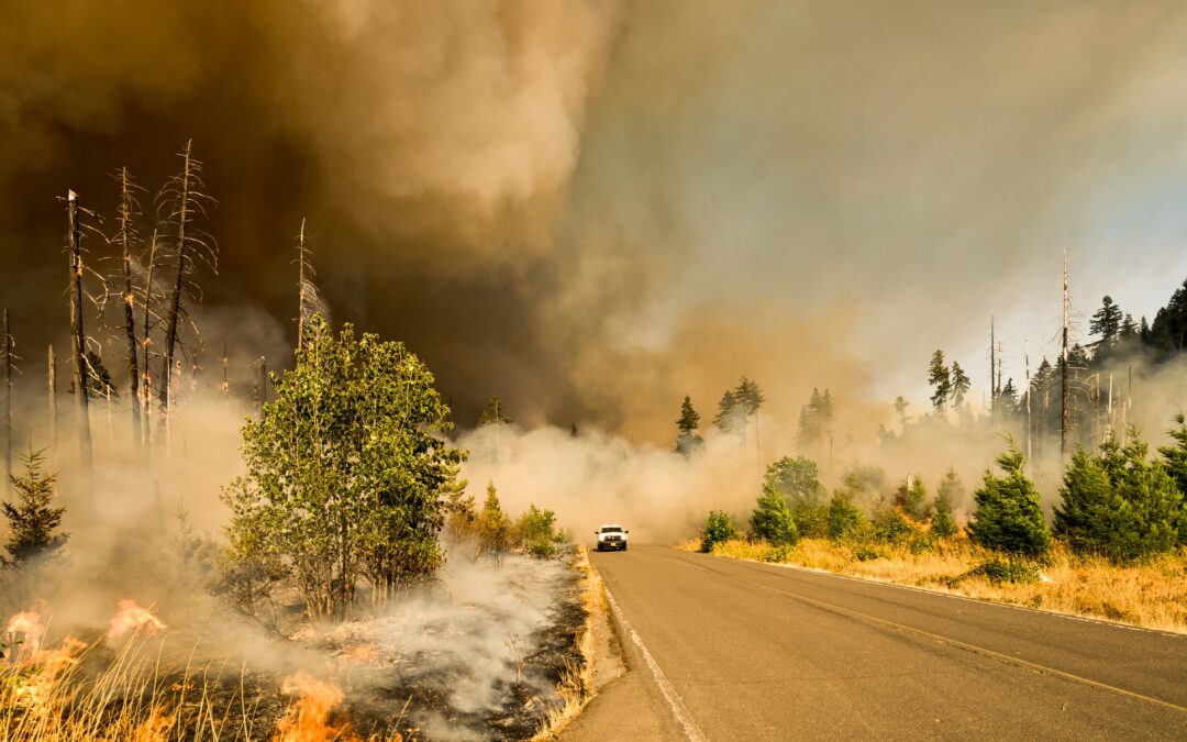
GIS is instrumental in natural hazard assessment and mitigation by analyzing vulnerability, identifying high-risk areas, and developing emergency response plans. GIS-based hazard mapping enables authorities to assess the potential impact of earthquakes, landslides, wildfires, and other natural disasters on human settlements and infrastructure. By integrating socio-economic data with hazard maps, GIS facilitates risk communication, evacuation planning, and disaster preparedness measures, ultimately reducing the loss of life and property.
In forestry management, GIS supports sustainable forest planning, monitoring, and enforcement of forestry regulations. GIS-based forest management systems integrate data on tree species, age classes, and forest health to optimize timber harvesting operations and biodiversity conservation. Furthermore, GIS enables real-time monitoring of deforestation, illegal logging activities, and forest fires through remote sensing and satellite imagery analysis, aiding in law enforcement and ecosystem protection efforts.
Conclusion: In conclusion, Geographic Information Systems (GIS) play a pivotal role in natural resource management, offering a suite of powerful tools for analysis, planning, and decision-making. From mapping and inventorying resources to assessing environmental impacts and guiding conservation efforts, GIS facilitates sustainable development and responsible stewardship of our planet’s natural resources.
MicroGenesis: MicroGenesis, a leader in GIS solutions, has launched its IndiGIS platform, designed to empower businesses with powerful tools for managing and analyzing spatial data. IndiGIS offers a comprehensive GIS software solution, providing a wide range of applications to enhance decision-making capabilities and drive greater efficiencies for our clients in natural resource management and beyond. With IndiGIS, businesses can unlock the full potential of GIS technology to address environmental challenges and contribute to a more sustainable future.
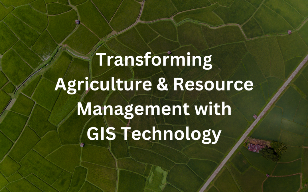
In recent years, Geographic Information Systems (GIS) have revolutionized the way agriculture and natural resources are managed. By integrating spatial data with advanced analytical tools, GIS technology offers invaluable insights that help optimize agricultural practices, preserve natural resources, and ensure sustainable land management. In this blog post, we’ll delve into the various applications of GIS in agriculture and natural resource management, highlighting its significance in addressing key challenges and driving innovation in these sectors.
1. Precision Agriculture: One of the most significant applications of GIS in agriculture is precision agriculture. By collecting and analyzing spatial data such as soil properties, weather conditions, and crop health, farmers can make informed decisions regarding planting, irrigation, fertilization, and pest control. GIS tools enable farmers to create detailed maps of their fields, identify areas with specific needs, and implement targeted interventions to maximize crop yields while minimizing resource inputs.
2. Crop Monitoring and Management: GIS technology facilitates real-time monitoring of crop health and growth using satellite imagery and remote sensing data. By analyzing vegetation indices and other indicators, farmers can detect anomalies, identify crop stressors, and take corrective actions promptly. GIS-based crop monitoring systems enable farmers to optimize inputs, detect diseases early, and implement precision agriculture practices tailored to specific crop requirements.
3. Soil Conservation and Management: GIS plays a crucial role in soil conservation and management by providing insights into soil erosion, moisture levels, and nutrient distribution. By mapping soil properties and erosion-prone areas, land managers can implement conservation practices such as contour farming, terracing, and buffer strips to mitigate soil erosion and preserve soil fertility. GIS tools also facilitate soil sampling and analysis, enabling farmers to make data-driven decisions regarding soil amendments and nutrient management.
4. Water Resource Management: Water is a precious resource in agriculture, and GIS technology helps optimize its use through efficient water resource management practices. By mapping watersheds, aquifers, and water sources, land managers can assess water availability, plan irrigation systems, and monitor water usage. GIS-based hydrological modeling allows for the simulation of water flow, rainfall runoff, and groundwater recharge, facilitating informed decision-making in water resource allocation and conservation efforts.
5. Biodiversity Conservation: GIS contributes to biodiversity conservation by providing tools for habitat mapping, species monitoring, and ecosystem assessment. Conservation organizations use GIS to identify critical habitats, monitor wildlife populations, and prioritize conservation areas based on ecological significance. By analyzing spatial data on land cover, vegetation types, and habitat connectivity, conservationists can develop effective strategies for preserving biodiversity and restoring degraded ecosystems.
6. Land Use Planning and Management: GIS is instrumental in land use planning and management, helping policymakers and land managers make informed decisions about land allocation and development. By analyzing land cover, land use patterns, and demographic data, planners can identify suitable locations for agriculture, urban development, and conservation areas. GIS-based land use planning facilitates sustainable development, minimizes land-use conflicts, and balances competing demands for land resources.
7. Disaster Risk Management: GIS technology supports disaster risk management efforts by providing tools for hazard mapping, vulnerability assessment, and emergency response planning. By analyzing spatial data on natural hazards such as floods, wildfires, and droughts, emergency responders can identify high-risk areas, develop evacuation plans, and coordinate disaster response operations. GIS-based risk mapping helps communities prepare for and mitigate the impacts of natural disasters, enhancing resilience and reducing vulnerability.
Conclusion: In conclusion, Geographic Information Systems (GIS) play a crucial role in agriculture and natural resource management by providing tools for precision agriculture, crop monitoring, soil conservation, water resource management, biodiversity conservation, land use planning, and disaster risk management. By harnessing the power of spatial data and advanced analytical tools, GIS technology empowers farmers, land managers, and policymakers to make informed decisions, optimize resource use, and ensure sustainable land management practices for future generations.
Unlock the Power of GIS Systems in Agriculture and Natural Resource Management with MicroGenesis-IndiGIS Technology. Our solutions harness the full potential of GIS technology to empower businesses across industries with spatial analysis, data visualization, and custom application development. With our experienced team, we ensure innovative solutions tailored to drive tangible business outcomes and gain a competitive edge.
Climate change is no longer a distant threat; it’s a global crisis that requires immediate and concerted action. The impacts of climate change, including rising sea levels, extreme weather events, and shifting climate patterns, are affecting communities, economies, and ecosystems worldwide. To combat these challenges, innovative technologies like Geographic Information Systems (GIS) are playing a crucial role. In this blog, we’ll explore how IndiGIS Services, provided by MicroGenesis, is at the forefront of this battle, helping us monitor, mitigate, and innovate in the face of climate change.
Understanding the Climate Change Challenge
Before we dive into the role of IndiGIS Services, let’s briefly examine the magnitude of the climate change challenge. The Earth’s climate is warming at an unprecedented rate due to human activities, primarily the emission of greenhouse gases such as carbon dioxide (CO2) and methane (CH4). These emissions trap heat in the atmosphere, leading to global temperature rise.
The consequences are far-reaching:
Sea-Level Rise: As global temperatures increase, polar ice caps and glaciers melt, causing sea levels to rise. Coastal communities are particularly vulnerable, facing the threat of flooding, erosion, and saltwater intrusion.
Extreme Weather Events: Climate change intensifies extreme weather events, including hurricanes, droughts, heatwaves, and wildfires. These events disrupt lives, damage infrastructure, and strain resources.
Biodiversity Loss: Shifts in temperature and precipitation patterns endanger ecosystems and wildlife, leading to habitat loss and species extinction.
Food and Water Security: Changing climate conditions can disrupt agriculture, affecting food production. Additionally, altered precipitation patterns can lead to water scarcity in many regions.
Health Risks: Climate change exacerbates health risks, including heat-related illnesses, vector-borne diseases, and air pollution.
The Role of IndiGIS Services in Climate Change
IndiGIS Services, developed and provided by MicroGenesis, is a comprehensive geospatial solution that empowers organizations and governments to address the multifaceted challenges posed by climate change. Here’s how IndiGIS Services is making a difference:
1. Climate Monitoring and Modeling
IndiGIS Services enables scientists and researchers to monitor climate change through advanced modeling and data analysis. This technology facilitates:
Climate Modeling: Sophisticated climate models simulate future climate scenarios, helping us understand temperature changes, precipitation patterns, and more.
Sea-Level Rise Projections: By integrating elevation data with sea-level rise projections, IndiGIS Services identifies vulnerable coastal areas, allowing for informed adaptation planning.
Extreme Weather Analysis: IndiGIS tools track and map extreme weather events, providing essential information for emergency response and preparedness.
To combat climate change effectively, we need a constant influx of data. IndiGIS Services plays a crucial role in collecting and managing climate-related data:
Satellite Imagery: Remote sensing satellites provide valuable data on temperature, vegetation health, and land cover changes. IndiGIS processes and analyzes this data to detect trends and anomalies.
Weather Stations: IndiGIS manages and visualizes data from weather stations worldwide, offering insights into local climate conditions and patterns.
Sensor Networks: IoT (Internet of Things) sensor networks collect real-time environmental data. IndiGIS aggregates and analyzes this data, monitoring air quality, temperature, and other relevant factors.
3. Climate Change Mitigation
Mitigating the effects of climate change requires informed decision-making and proactive measures. IndiGIS Services supports these efforts:
Renewable Energy Planning: IndiGIS helps identify suitable locations for renewable energy projects like wind farms and solar arrays. It considers factors such as sunlight, wind speed, and accessibility, facilitating the transition to clean energy sources.
Urban Planning: Sustainable cities with reduced carbon footprints are vital for climate action. IndiGIS aids in decisions on public transportation, green spaces, energy-efficient building placement, and more.
Natural Resource Management: Conservation efforts benefit from IndiGIS by identifying critical habitats, managing forests, and preserving biodiversity.
Disaster Preparedness: IndiGIS-based risk assessment and early warning systems enable communities to prepare for extreme weather events, reducing potential impacts.
In the face of climate change, innovation is key. IndiGIS Services encourages forward-thinking solutions:
Precision Agriculture: IndiGIS helps optimize agriculture by providing insights into crop management, soil analysis, and resource allocation, ultimately increasing food production efficiency.
Climate-Resilient Infrastructure: Using GIS, engineers and architects can design infrastructure that can withstand climate-related challenges, such as flooding and extreme temperatures.
Indigenous Knowledge Integration: IndiGIS Services respects and integrates indigenous knowledge, preserving and promoting land rights, cultural heritage, and sustainable practices.
Conclusion: Embracing IndiGIS Services for a Sustainable Future
The fight against climate change requires a collective effort. IndiGIS Services, provided by MicroGenesis, empowers us with the tools and insights needed to understand, monitor, mitigate, and innovate in response to this global crisis. As climate change continues to challenge us, IndiGIS Services stands as an indispensable ally in our quest to create a more sustainable and resilient future for generations to come. With the power of geospatial technology and a commitment to environmental stewardship, we can address climate change head-on and pave the way toward a greener, more sustainable planet.
Amidst the backdrop of dynamic security challenges and a constantly evolving technological terrain, IndiGis emerges as an indispensable asset, arming defense and intelligence agencies with cutting-edge geospatial solutions. Its role encompasses strategic mapping, real-time data integration, cross-border surveillance, and humanitarian assistance, all contributing to enhanced operational efficiency and security.
In this blog post, we will investigate the various avenues through which IndiGis, confers a decisive edge to the defense and intelligence sectors.
1. Geospatial Intelligence (GEOINT):
IndiGis plays a pivotal role in the generation of Geospatial Intelligence (GEOINT). By integrating geographical data with other forms of intelligence, GEOINT helps military and intelligence agencies understand the physical environment in which they operate. This includes terrain analysis, mapping enemy positions, and monitoring potential threats.
2. Effective Resource Allocation:
Defense and intelligence agencies often operate under budgetary constraints. IndiGis assists in optimizing resource allocation by analyzing spatial data to identify critical areas that require attention. This can range from planning troop deployments to deciding where to establish surveillance infrastructure.
3. Real-time Situational Awareness:
In an ever-changing world, real-time situational awareness is paramount. IndiGis technology allows defense and intelligence agencies to monitor events as they unfold. This includes tracking troop movements, monitoring natural disasters, and assessing the impact of geopolitical developments.
4. Logistics and Supply Chain Management:
Logistics are the lifeblood of defense operations. IndiGis helps streamline the movement of personnel and equipment by identifying efficient routes, managing supply chains, and ensuring timely deliveries. This not only saves resources but also enhances operational readiness.
5. Border and Maritime Security:
Securing borders and coastlines is a complex task. IndiGis aids in border surveillance, detecting intrusions, and monitoring maritime traffic. It provides agencies with a comprehensive view of their territory, allowing them to respond swiftly to potential threats.
Natural disasters and humanitarian crises demand rapid response. IndiGis enables agencies to assess the impact of disasters, plan evacuation routes, and coordinate relief efforts. It plays a crucial role in saving lives and mitigating the aftermath of catastrophes.
7. Predictive Analysis:
IndiGis can be used for predictive analysis by modeling potential future scenarios. For example, it can simulate the effects of a military operation or predict the spread of a disease. This foresight is invaluable in strategic planning.
8. Collaboration and Information Sharing:
In the world of defense and intelligence, collaboration is essential. IndiGis facilitates information sharing among various agencies, both domestically and internationally. It helps create a common operational picture, fostering cooperation and coordination.
Conclusion:
In a rapidly evolving security landscape, IndiGis Solutions, offered by MicroGenesis, stands as a force multiplier for defense and intelligence agencies. Its ability to harness geospatial data, enhance situational awareness, and support informed decision-making makes it an indispensable tool. As technology continues to advance, the role of IndiGis in providing an edge to defense and intelligence will only become more prominent. Embracing IndiGis is not just a choice; it’s a necessity for staying ahead in the complex world of national security and intelligence.
In this dynamic era of rapid technological advancements, staying ahead of the competition is no longer a luxury; it’s a necessity. Businesses and organizations are navigating the data-driven landscape, seeking innovative tools that unlock hidden opportunities and optimize strategies. Enter Geographic Information Systems (GIS), a game-changing technology that promises to revolutionize the way you operate and elevate your success to unprecedented heights. As proud representatives of MicroGenesis, a renowned GIS solutions provider, let’s embark on a journey to uncover the top benefits of GIS and witness how it can transform your business landscape.
1. Enhanced Decision-Making:
One of the most significant advantages of GIS lies in its ability to visualize and analyze complex spatial data. By integrating data from various sources onto a single map, decision-makers gain valuable insights into relationships, patterns, and trends that would otherwise remain hidden. With GIS, you can make informed decisions, identify potential opportunities, and address challenges more efficiently.
2. Improved Planning and Resource Management:
GIS empowers organizations to optimize resource allocation and streamline workflows. For instance, urban planners can use GIS to design efficient transportation networks, healthcare providers can identify underserved areas, and environmental agencies can monitor natural resources and wildlife habitats. With GIS, you can create well-informed strategies for sustainable growth and resource management.
3. Effective Customer Engagement:
Incorporating GIS into customer engagement strategies can be a game-changer. By utilizing location-based data, businesses can better understand customer behavior, preferences, and needs. This, in turn, facilitates targeted marketing campaigns, personalized offers, and improved customer experiences. GIS-powered location intelligence enables businesses to deliver the right message to the right audience at the right time.
4. Precise Market Analysis:
For businesses seeking to expand their operations or open new branches, GIS offers invaluable market analysis capabilities. GIS tools can overlay demographic data, competitor locations, and consumer behavior patterns to identify untapped markets and potential growth areas. Understanding the geographical context helps companies make strategic decisions and minimize risks associated with expansion.
5. Efficient Asset Management:
GIS plays a vital role in managing physical assets efficiently. Whether it’s managing utility infrastructure, transportation networks, or public facilities, GIS can track, monitor, and maintain assets effectively. By integrating real-time data with GIS, organizations can improve asset performance, reduce downtime, and extend the lifecycle of critical infrastructure.
6. Disaster Preparedness and Response:
During times of crisis, GIS proves indispensable in disaster preparedness and response efforts. Emergency services can leverage GIS to analyze affected areas, plan evacuation routes, and coordinate relief operations. By visualizing real-time data, responders can prioritize resources where they are needed most, saving lives and minimizing damage.
GIS promotes collaboration and communication across diverse teams and departments. By centralizing data on a shared platform, stakeholders can access up-to-date information, reducing miscommunication and duplication of efforts. GIS facilitates a unified approach to problem-solving and fosters a collaborative environment for innovation.
Conclusion:
The benefits of Geographic Information Systems (GIS) extend far beyond what is covered in this blog. As MicroGenesis, a trusted GIS solutions provider, continues to push the boundaries of spatial technology, organizations of all sizes can harness the power of GIS to drive innovation, optimize operations, and make data-driven decisions. Embrace the transformative potential of GIS and unlock new opportunities for your business to thrive in a dynamic world.
Disasters are a common occurrence in many parts of the world. From natural disasters like earthquakes, floods, and wildfires to man-made disasters like oil spills and industrial accidents, these events can cause significant damage to the environment and human life. The ability to respond quickly and effectively to these disasters is critical in mitigating their impact and helping affected communities recover. One tool that has become increasingly important in disaster response and recovery efforts is Geographic Information Systems (GIS).
At MicroGenesis, we specialize in providing indigenous IndiGIS solutions that help Defence Forces, Para Military Forces and governments organisation to make informed decisions and allocate resources effectively in disaster response and recovery efforts. Our team of experts has extensive experience in working with geospatial data and developing custom GIS solutions that meet the unique needs of each client.
Here are some of the ways in which MicroGenesis IndiGIS solutions can play a critical role in disaster response and recovery:
Disaster Preparedness: MicroGenesis IndiGIS solutions can help organizations and governments prepare for potential emergencies by mapping out vulnerable areas and identifying potential risks. This information can be used to develop emergency plans that take into account the unique characteristics of each community.
Disaster Response: During a disaster, MicroGenesis IndiGIS solutions can help decision-makers understand the scope and scale of the event by collecting real-time data on the location and severity of the disaster. This information can be used to identify the most urgent needs and allocate resources effectively.
Resource Allocation: MicroGenesis IndiGIS solutions can help Defence Forces, Para Military Forces and governments organisation to allocate resources effectively by mapping out the location of emergency responders, equipment, and supplies. This information can help ensure that resources are being deployed to the areas that need them the most.
Damage Assessment: MicroGenesis IndiGIS solutions can help Defence Forces, Para Military Forces and governments organisation to assess the extent of the damage and prioritize recovery efforts by using satellite imagery and other remote sensing technologies. This information can be used to identify which areas need the most immediate attention and allocate resources accordingly.
Disaster Recovery: MicroGenesis IndiGIS solutions can help communities recover by mapping out the location of damaged infrastructure and buildings. This information can be used to identify which areas need to be rebuilt or repaired first, and to prioritize recovery efforts based on the needs of the affected population.
Resource Distribution: MicroGenesis IndiGIS solutions can help ensure that affected communities have access to the resources and support they need to rebuild by mapping out the location of temporary housing, food distribution centers, and other resources. This information can help ensure that these resources are being distributed fairly and efficiently.
Cross-Border Disaster Response: MicroGenesis IndiGIS solutions can facilitate cross-border disaster response efforts by helping organizations and governments coordinate their response efforts and share critical information. This can be particularly important in the case of large-scale disasters that affect multiple countries.
In conclusion, MicroGenesis IndiGIS solutions play a critical role in disaster response and recovery efforts. By providing decision-makers with real-time data and helping to allocate resources effectively, our solutions can help mitigate the impact of disasters and support affected communities as they work to rebuild.
We use cookies to ensure that we give you the best experience on our website. If you continue to use this site we will assume that you are happy with it.Ok